
Mausi on the roof, overlooking Africa
Private homepage – Hans-Georg Michna
Kenya travel reports: 1999, 2000, 2002, 2003, 2004, 2005, 2006, 2007, 2008, 2009, 2010, 2011, 2012, 2013-Goma, 2013, 2014, 2015, 2016, 2017, 2018, 2019
Kenya Safari Travel Plan, Kenya 1980-2000 photos
Kenya 2011
A personal travel report from Kenya in May and June 2011
Last change: 2011-07-24 – Copyright © 2011-2023 Hans-Georg Michna
Click on the small pictures to see them enlarged, usually to 800 x 600 pixels.
Times are given in local Kenyan time in 24 h format (without "am" or "pm"), i.e. 0:00 to 23:59 o'clock.
A few readers had the problem that after clicking on a picture, then going back to the main page, all thumbnail pictures were reloaded. This is typically caused by Internet Explorer cache corruption. It can often be repaired by going to the Internet options and deleting the temporary Internet files.
All photos are subject to copyright ©. If you want to reuse any photo, send me an email asking for permission, and I may send you the full-size photo, usually 1,600 x 1,200 pixels. Photos bear the copyright © 2011-2023 Hans-Georg Michna.
EXIF times in the pictures are UTC; add 3 hours to get Kenya time.
[Still the same camera—my Panasonic Lumix DMC-FZ1-2 digital camera. Most photographs in this travel report are reduced to 800 x 600 pixels and JPEG-compressed with medium strength to make them more palatable for the web.]
| Departure | Arrival | Flight |
|---|---|---|
| 07:20 Sun 15 May, Munich | 09:00 Sun 15 May, Paris CDG | AF 1123 |
| 11:00 Sun 15 May, Paris CDG | 20:30 Sun 15 May, Nairobi | AF 8002 |
| 22:30 Sat 4 June, Nairobi | 06:20 Sun 5 June, Paris CDG | AF 8003 |
| 08:15 Sun 5 June, Paris CDG | 09:45 Sun 5 June, Munich | AF 1522 |
My travelling checklist in michna.com/kenya.htm#Preparations (German version michna.com/kenia.htm#Reisevorbereitungen) is, as always, my means of packing without fear of forgetting anything important. As usual, the packing and other preparations take at least a full day of concentrated work, because they cover an immense number of small things and details. Without the checklist I'd be lost.
KLM, Air France, and Kenya Airways on their flights to Nairobi currently allow two pieces of baggage of up to 23 kg each in the economy class. KLM also has a pretty good and informative web site, allowing ticket purchase, online check-in, and often seat selection.
My experience on such international flights, particularly from Nairobi, is that a lot of stress can be taken out of the check-in procedure by being at the airport just 10 to 15 minutes earlier than needed. In Munich the rush seems to begin 90 minutes before departure, in Nairobi at least two hours. Be there before that rush and everything is a lot more relaxed.
This time I had no safari group with me. Only my wife accompanied me.
This trip is also the first time I travel with a capable smartphone (a Google/HTC Nexus One), trying to replace my aging Garmin GPSMap 60C. Please see the chapter Smartphone at the end for details.
The flight was uneventful, timely, and fairly nice. Because of the civil war and the NATO no-fly-zone over Libya, the airliner took a route from Paris across Italy, touching Greece and Crete, flying just around the northeastern corner of Libya, then on to Khartoum – Lodwar – Nairobi.
The sun set before we reached Lake Turkana, and the area was cloudy. We landed 15 min early, but then had to wait in the plane until its designated docking position was cleared.
Because of our experience with the Nairobi international airport, we were able to bypass most of the waiting lines for visa and immigration and made it to the luggage belt just when our luggage passed by, all pieces next to each other.
We collected our Suzuki Maruti Gypsy off-road car and drove off to the Aero Club of East Africa inside Wilson Airport, hoping to catch the last sounds of the jazz band that had been playing there this evening, but they had already finished their performance. So we went to the bar, greeted the people there, chatted and drank a bit, then went to bed in our nice room.
I had to do several things on this Monday, particularly visiting a doctor to get a flying medical certificate and renewing my Kenyan pilot license. But first we went to a mobile phone shop at Wilson Airport, bought two local pre-paid SIM cards, and loaded them with a sufficient amount for a largish Internet data pack. After several little problems and solutions (our phones did not have the local provider's settings in their database), we finally had good and fast Internet connections on both of our Android smartphones.
If any of our friends wants to follow our position through Google Latitude, please send either of us an email or just request the Latitude participation if we already know your Google Mail address.
The medical examination went smoothly, and I barely made it to the Kenya Civil Aviation Authority (KCAA) in time before their lunch break.
After lunch in the Aero Club we drove to the entrance of Nairobi National Park to check our safari chip card, only to learn that the system has been abandoned. This is very good for us, as the handling of the cards was a constant hindrance and required meticulous, mostly unalterable planning. But we will see tomorrow how this goes in practice.
After than I gave a little lesson in web design and did a little work on the web site of the company on Wilson Airport from which I usually rent an aeroplane, African Sky Charters. I had set up a small web site for them that they can alter without having to use special software.
Finally we had a good dinner, and now I am sitting on the Aero Club's terrace in the somewhat cooler air of the evening, typing this text.
After a nice breakfast in the Aero Club in the morning sun we drove off towards Amboseli.
After a couple of minutes in a small part of the Nairobi morning rush hour traffic jam we made it onto the Mombasa Road and drove southeast to Athi River. It turned out that the Athi River junction with the Namanga road was still under construction, like last year, and we had to drive back to find the turnoff to a smaller old road that leads to the Namanga road.
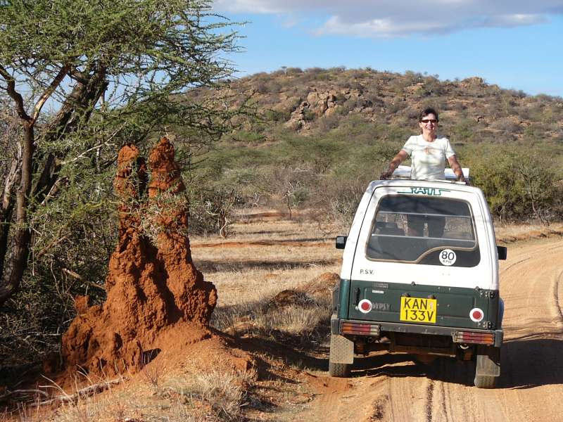
We filled the tank in Kitengela, not far from Athi River, and continued south towards Kajiado, Bissil, and Namanga. Along this road we branched off to pay a short visit to friends who live up in the mountains in a wonderful house overlooking almost half of Kenya.
Mausi on the roof, overlooking Africa
Back on the road we continued to Namanga, topped up the tank with another 10 l (fuel is not guaranteed in Namanga, hence the double take), bought a few cabbages, onions and fruit for the elephant research camp, and continued along the Tanzanian border to find a route that I had driven many years ago. We wanted to find it because the main road is by now pretty badly corrugated.
We did find it by means of my old GPS waypoints and found that two of the waypoints have to be shifted, because the road itself, actually just a car track in the sandy area occupied by many Maasai villages, had shifted in two places. But that road still turned out to be much nicer to drive than the corrugated main road.
The only problem was dust. It was not as bad as I feared, but later, after arriving in the Ol Tukai Lodge, we had to dust off each piece of luggage by beating it with a towel, except for those pieces we had wisely packed into some large plastic bags.
We reached Meshenani Gate of this nature reserve, which is managed by the Kenya Wildlife Service (KWS), and confirmed that the smartcards are indeed being phased out and that we could now pay at the gate. Except that for some strange reason this gate, which used to be the main payment entrance, was no longer permitted to take money. We were told that we have to drive to Iremito Gate today to pay. This was not necessary in earlier years, so the system has deteriorated again for us.
We later went to the airfield to check whether we could pay there by credit card, but they could accept only Visa, not our MasterCard. But the man at the airfield was apparently high enough in rank to grant us another day until we pay at Iremito Gate. Note that this was an individual favor, not a more sensible rule. And we still had to drive out to that gate at a time when we did not actually want to.
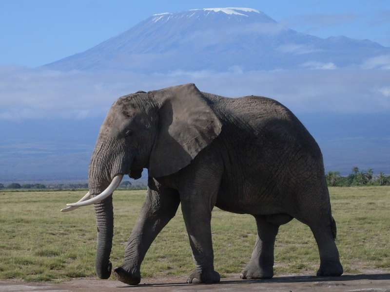
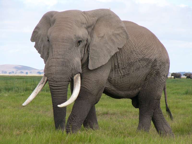
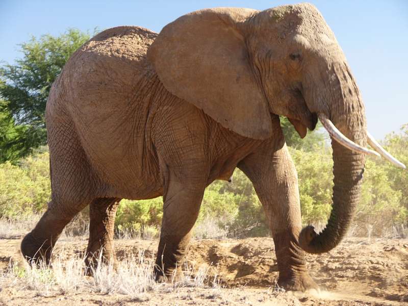
Elephant bull in front of Kilimanjaro
Since we had already heard that Amboseli lacked any heavy rains this year, we drove right into Lake Amboseli and raced across its perfectly level surface. Then we continued past the airfield to the elephant research camp.
We dropped off our fresh vegetables and fruit in the camp, greeted the people there, and continued to the lodge, where we ended our day with a hot shower to remove the dust and a nice five-course dinner.
This was our first day to come to rest. We skipped the usual early morning game drive, had breakfast first, then drove to Iremito Gate to pay the entrance fee and drove back in a wide arc around the western side of the main swamp area.
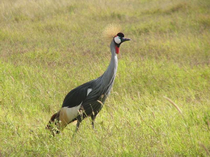
Crowned crane
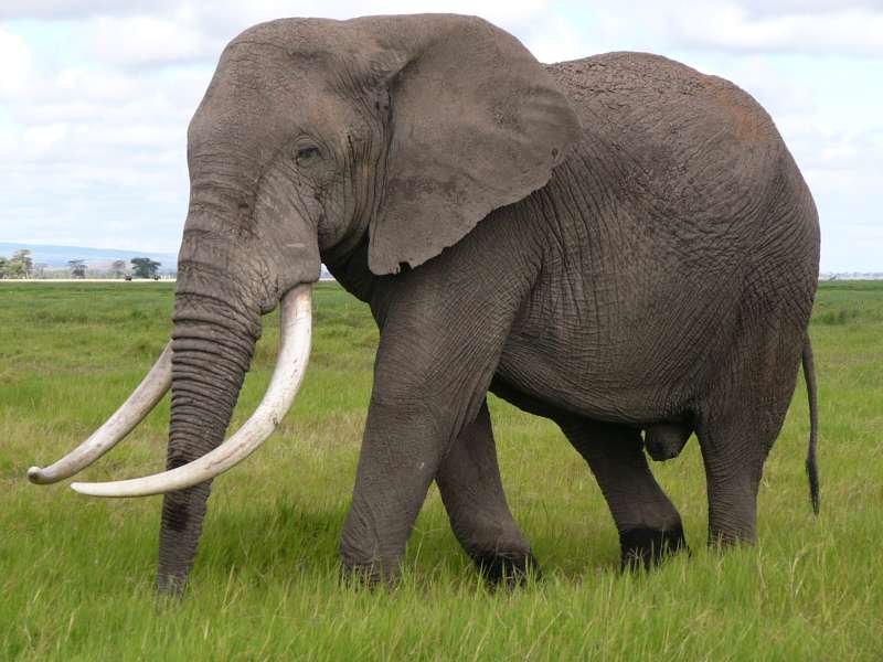
Among the many animals we saw were lots of elephants, mostly in or near the swamp. We admired the gentle giants.
We visited the elephant research camp and met Graeme Shannon (see last year's travel report), who happened to be here again to continue his elephant communications research project. He could meanwhile prove that older, most experienced elephant matriarchs can not only count lions by listening to them, but can also detect numbers of male and female lions in a pride by ear.
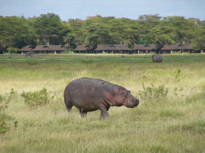

Left: hippo with Ol Tukai Lodge in the background; right: same hippo
Later, around sunset, we did a shorter game drive around Ol Tukai Orok, the swamp where the elephant research camp lies. At dusk we saw the first hyaenas, coming out for their nightly hunts. As it got dark, they seemed to lose some of their shyness. One of them rested on the ground 4 m from us, looked at us, but stayed completely calm and showed no signs of moving.
After dinner we sat at the open fire in front of the lodge for a while, before we went to bed early.
I woke up at 5 and heard a pride of lions perhaps 1 km from the lodge. We should never see them, but we later did two drives, a shorter one in the morning and a longer one to the western side of the nature reserve in the afternoon.
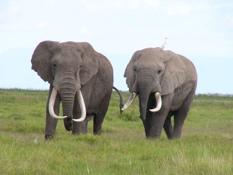
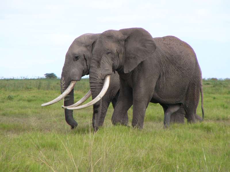
Two elephant bulls in musth
Among other animals we met two elephant bulls in musth. Both were wounded. As you can see, one of them had a fresh scar on the side of his lower skull between eye and tusk root. The other had several black spots around his eye. These are typical fighting wounds that are caused by the tip of a tusk.
The most likely explanation is that these bulls, both equal in size, were in a protracted fight that had not yet ended decisively. We found this out only later, by looking at the photos and asking Graeme, the elephant researcher.
To see elephants we did not even have to drive. We could always see quite a few from our lodge hut in the swamp just outside the lodge compound.
We had our dinner in the lodge with Graeme and Catherine "Katito" Namunyak Sayialel, another one of the elephant researchers. She lives here and knows the resident elephants instantly on sight.
After breakfast we set off for a last drive through Amboseli to Iremito Gate, through which we left and drove on, back to Nairobi.
The drive was uneventful, but showed again that even on one of the best roads in Kenya our average speed is still below 50 km/h. The main reasons are heavy and slow truck traffic, slow because of going uphill and the many hills to climb, and some diversions with very low driving speeds.
We had originally intended to visit Lake Nakuru National Park, but the Kenya Wildlife Service (KWS) prevented that. Our plan was to drive in through Lanet Gate near the road from Nairobi, continue to Lake Nakuru Lodge, have lunch there, do an evening game drive and stay overnight in the lodge. The next morning we would do an early morning game drive, have breakfast in the lodge, check out and leave the park through the main gate on the northern side and continue north through Nakuru town.
But KWS has effectively closed all gates for us, because only the main gate takes our money, and there are very strange rules, prescribing that we may enter through Lanet Gate, but must then proceed immediately to the main gate and pay the entrance fee there within one hour of our entry.
This would have foiled our entire plan. We would not have reached the lodge in time for lunch. This means that we are entitled to a lunch on the next day, but if we took that, we would not reach the exit gate in time to stay within the paid 24 hours. So we would forgo part of the expensive lodge services, as the lodge only offers full-board accommodation. We would also have to drive a long and relatively uninteresting forest route almost completely around the lake, part of which we would have to drive back the next day.
We were not that keen on Lake Nakuru National Park anyway and were not willing to put up with this kind of senseless harrassment. So we decided quickly to skip Lake Nakuru and proceed to Baringo immediately. Nobody was willing or able to tell us why not every gate can let visitors pay. It was also unintelligible why we could not enter the park and pay when we leave on the next day, since we intended anyway to leave through the only gate that KWS was permitting to take the payment. In other words, they think that we are there to service their needs, rather than the other way around.
My general recommendation is to avoid KWS parks if you can, because you can never be sure what nonsense they come up with next. If you cannot or will not avoid them, inquire about the precise rules in place at the time of your visit, but I suspect that you will never find out about all of them, since they keep changing them. You always run the risk of having to perform a senseless dance to their tune of the day.
So we visited friends in Nakuru town and soon proceeded to Baringo. Surprisingly, it rained quite a bit along the way, particularly nearer to Baringo, and we arrived in continuous rain.
Rain is something wonderful for the semi-arid Baringo area. Sometimes it does not rain there for two years. People told us that it had already rained yesterday, and that they were very happy about the rain.
We drove straight to Roberts' Camp, a place where you can camp in your own tent, in a rented tent, in a banda (hut), or in a cottage.


Roberts' Camp
Since the three cottages were already taken, we moved into a banda and slept nicely.
In the early morning, some time before dawn, the birds began to sing. Baringo may well be the place in the world with the most observed bird species, more than 500. The morning concert was accordingly diverse. I could distinguish dozens of different tunes, only a few of which I can recognize, like the fish-eagle (Haliaeetus vocifer) and the go-away bird (Corythaixoides leucogaster).
This became our first real resting day, because we had no actions planned. It enabled me to work a little on the technical equipment and to keep this report up to date.
In Roberts' Camp we met a famous couple whose web site I had seen and admired before, Herta and Werner Beck. They were on their last trip around the world while writing a book about it, and after driving through Arabia as far east as Iran now criss-crossed Africa, leaving nearly no country untouched. They were now heading for various places in Kenya, then Tanzania, Uganda, Rwanda, Burundi, and through the Congo to the West Coast, then south and later out of Africa to Australia.
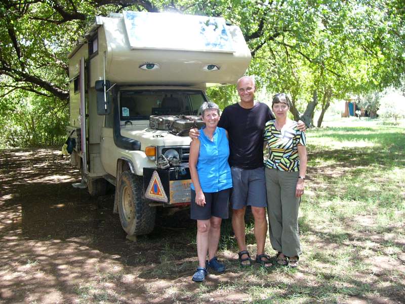
Herta and Werner Beck and Mausi with the Beck's solar-panel-covered camper
We visited the Bashir family, immigrants from Nubia (in southern Sudan) and still speaking Nuba, who live nearby and whom we have known for a long time.
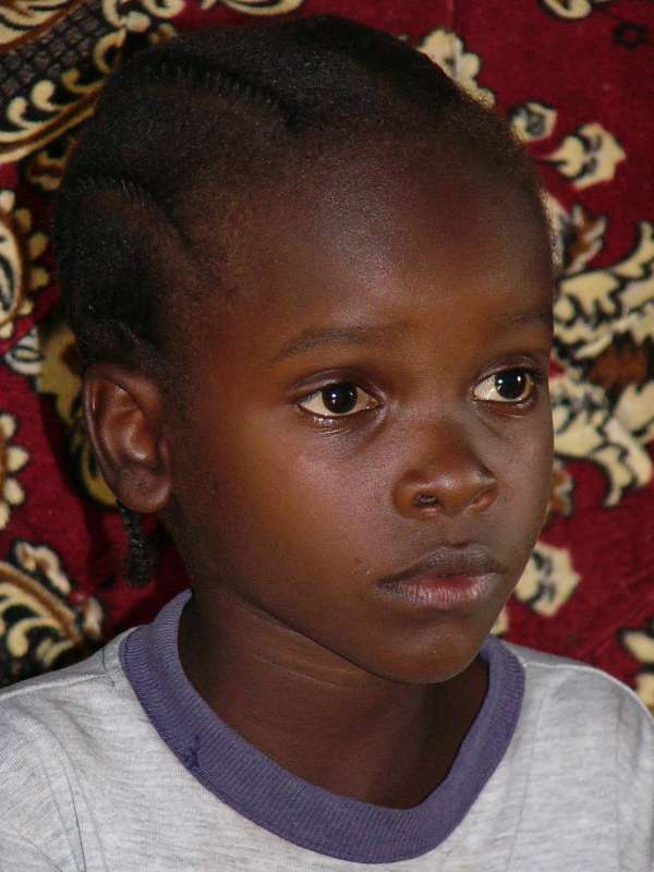

Two Bashir children
In the evening we visited the RAE Trust (Rehabilitation of Arid Environments) project.
We woke ourselves up quite early and drove out at 6:15. Later it showed that this was essential, because the road had deteriorated so much over the last few years that driving this route in the formerly common 8 or 9 hours was no longer possible. In fact it took us over 12 hours, and we arrived in the middle of dusk after racing the last bit through the nature reserve, which I do not like, but had to do.
The roads were bad almost the entire way, meaning that we could drive only around 30 km/h with stretches requiring 15 km/h. Apparently there have been heavy rains in the last few years in these areas that damaged the roads, and road here means gravel track that had been graded a long time ago, then left to decay.
Our route was Baringo – Loruk – Tangulbei – Churo – Mugie – Sukuta lol Marmar – Kisima – Lodungokwe – near Wamba – Sasaab airfield – Samburu West Gate – Samburu Lodge. At 11:30 we had a nice breakfast with boiled eggs in the Paradise Café in Sukuta lol Marmar. When I stepped in the kitchen to ask for water to wash my hands after eating some Mandazi (donut dough, fried) with the help of a water can, I almost accidentally stepped into the sleeping room of the owner, a friendly woman. The whole restaurant hut had only these three rooms, guest room, kitchen, sleeping room. They had one metal spoon though. We drove on at 12:00.
The first half of the road was partly still wet from recent rain, but we had no serious difficulties getting through, apart from the low speed. We met one truck on the Rumuriti road part of the way, one bus before that, 3 matatus (minibuses), 3 pickup trucks and 2 SUVs.
Finally we checked into Samburu (Game) Lodge, got a very nice 30% discount and probably the best hut they had.
In the dinner room we found that all guests of the entire lodge were acquaintances of ours and of each other, namely John Doherty, the giraffe researcher, and a Japanese photographer whom we had also met a year ago, with another Japanese visitor who was about to leave tomorrow.
These are some photos from our late morning and from the evening drive through the Samburu nature reserve.
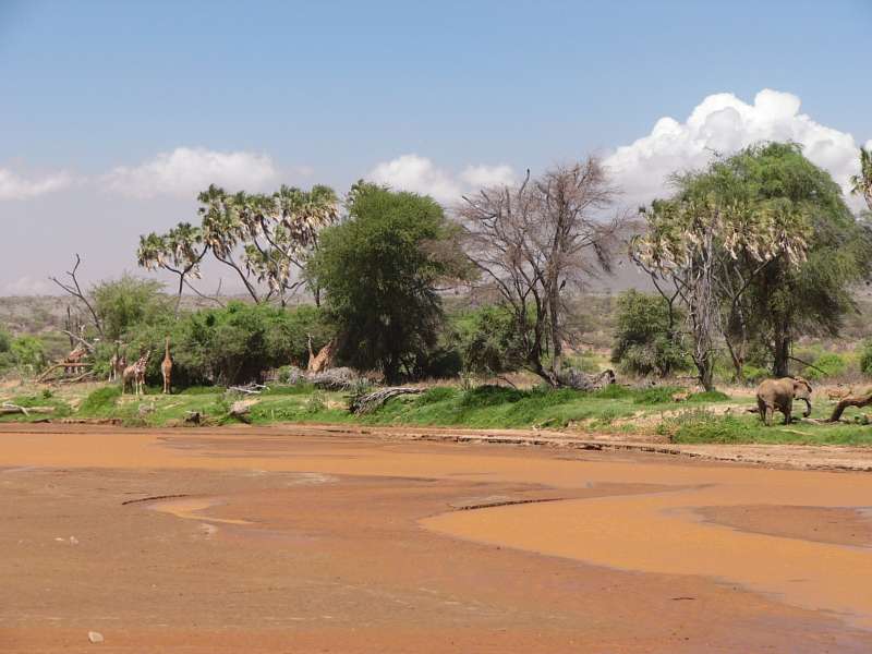
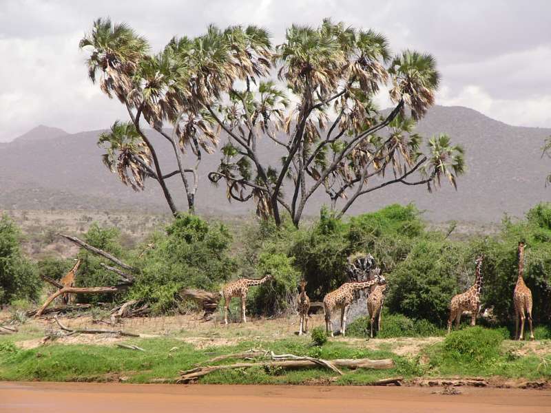
Giraffes and elephant across Samburu River

Left: our off-road safari car. Right: gerenuk mother and child
When the sun was already low, we turned back towards the lodge, only to find a leopard that had already got down from the tree in which she regularly sleeps and had begun to move around to prepare for the nightly hunt.
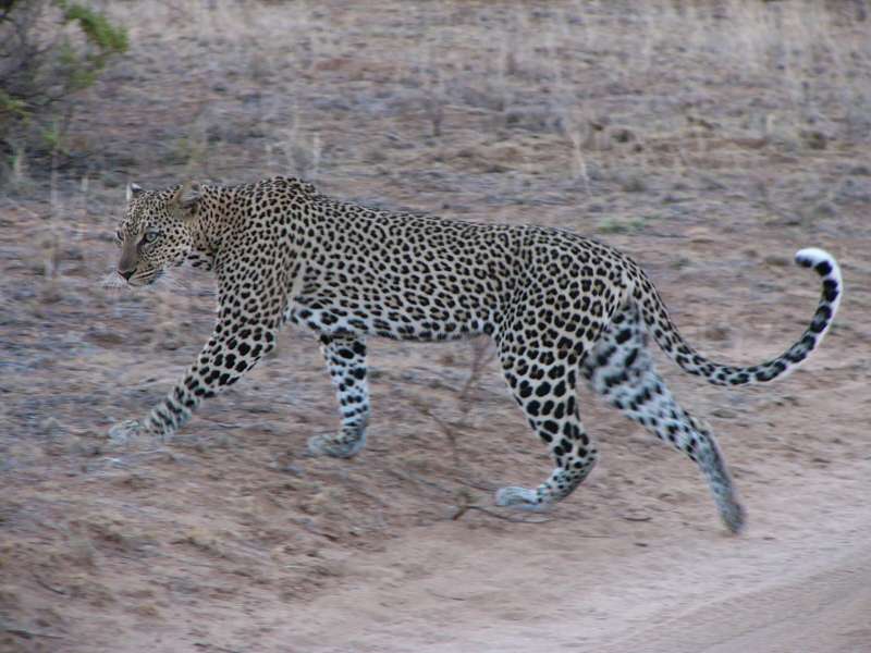
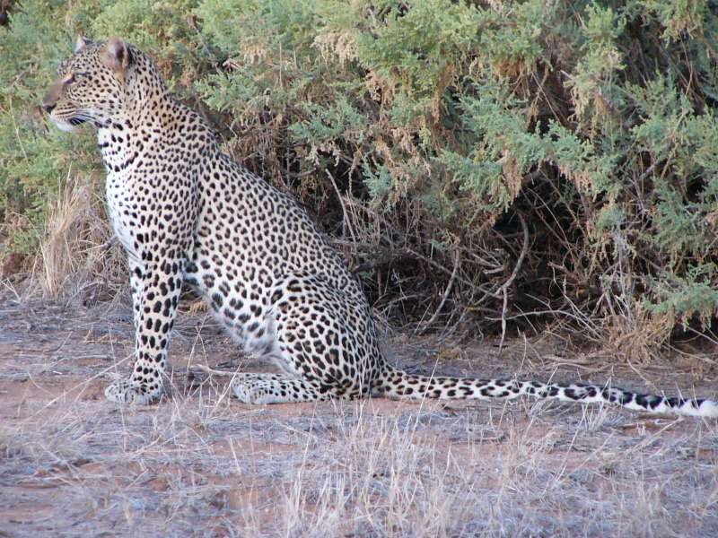
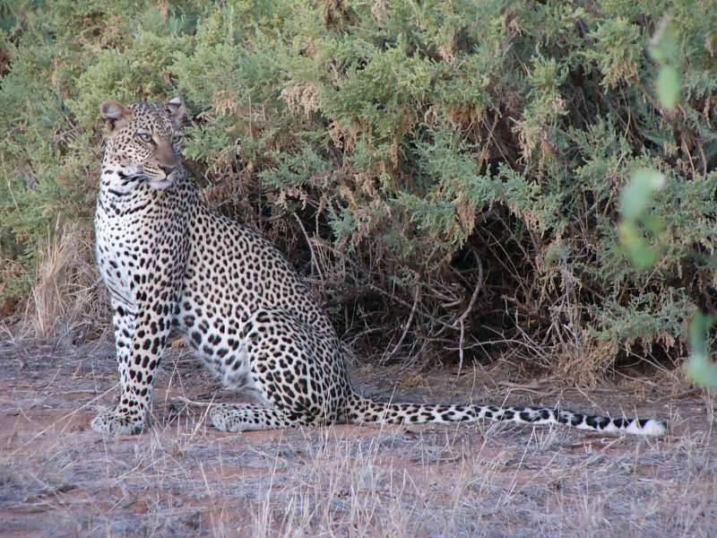
The leopard
How did we know that she was a she-leopard? This leopard is known by the local people in the lodge. A male leopard lives nearby, but on the other side of the river. Since leopards are rather strictly territorial, we could be quite sure that this was the known one.
We stayed with the leopard, sometimes resting with her, sometimes driving slowly next to her when she quietly walked through the bushes, seeing her through the gaps every so often.
She gradually seemed to get used to us or perhaps even enjoyed our company. Eventually she sat on the road in the sand and blocked our way. When she finally moved from the road, it was already almost pitch dark, so we switched on the headlights and moved on to the lodge, just in time for dinner.
It was a wonderful experience. I cannot remember having moved with a leopard for such a long distance and time before.
We went with John and witnessed his giraffe research. It was a wonderful, cool morning.

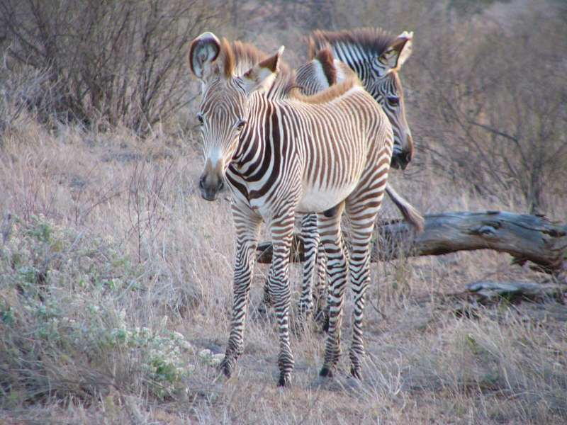
Grevy zebras
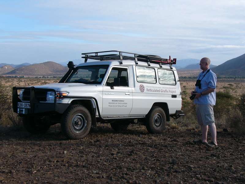
John Doherty and his research car
We stayed with a group of giraffes long enough to miss the normal breakfast time, but John's good relations with the entire lodge personnel ensured a nice late breakfast.
I later talked with him about ways to track giraffes automatically, and we came up with a whole range of good ideas.
A short evening game drive let us observe baboons, elephants, waterbucks and a number of smaller animals, but the low light did not yield photographs.
We had a nice quiet morning and a game drive and later set out to visit Shivani Bhalla, the lion researcher who has a camp in the West Gate Community outside the Samburu nature reserve.
To our big surprise Shivani told us that a pack of African hunting dogs (Lycaon pictus) has moved into the area and was near her camp almost every morning.
Her assistants thought they may still be nearby and went out to find them. Indeed they were still there, and we walked through the incredibly fascinating landscape to see them.
Unfortunately they seemed to be sleeping, were surprised by our approach, and after one warning bark all woke up and disappeared over the hill. I believe I barely caught a glimpse of them, but am not sure.
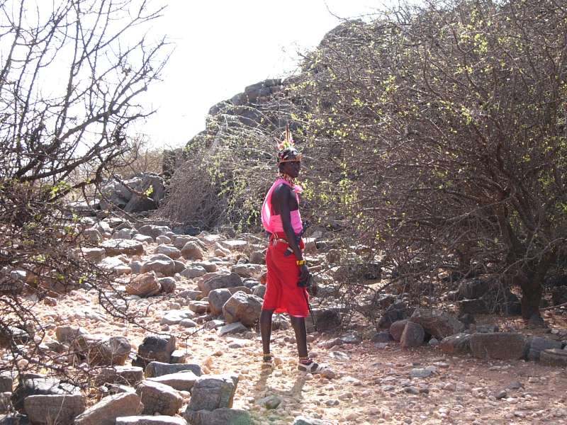
Samburu research assistant tracking African hunting dogs
So we drove back to the lodge, which can easily take two hours when you drive slowly and stop occasionally.
We did a morning game drive and found elephants, among others.
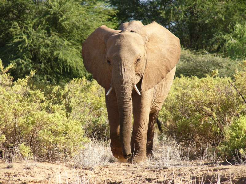
Elephants in Samburu
Then we received a message from Shivani, who was also here, tracking lions. She had found two females on the river bank, but was on the other side. She directed us from our lodge to the lions by GPS coordinates via SMS. In fact, we had already driven to a place about 8 m from the lions, but did not see them and turned back, when Shivani called us and directed us back to the same place, where the two lionesses were hiding on the river side of a bush. We only had to drive two meters further than we had gone before to see them.

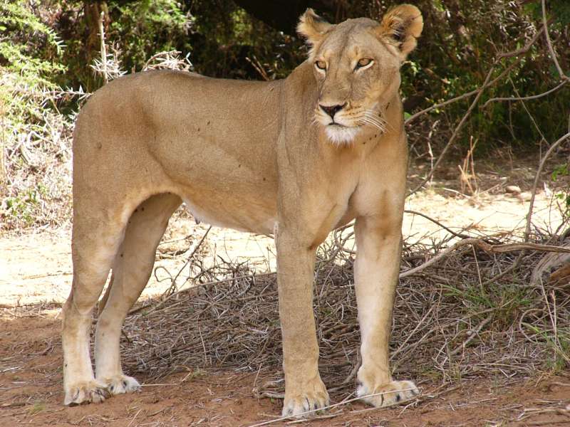
Two lionesses on the river bank
We all had lunch in the lodge and chatted for a good while. Later in the evening John took us to the Samburu Sopa Lodge up in the hills (next to Samburu Oryx airfield), where we had some drinks and watched the sunset.
This morning I joined John in his giraffe research drive again. He knows places with a wonderful view over the whole area, and we enjoyed these, while he spotted giraffes in the landscape that I would never have discovered.
Later in the day we received a message from Shivani that the wild dogs had again been at her camp this morning. Now we changed our plans in earnest and decided to make another effort to see them. This involves moving into her camp.
In the evening we went with John to the Samburu south airfield to check for giraffe movements.
[Sorry that some of the later pictures are not clickable. Our Internet connection is currently so bad that we can only manage to upload the small thumbnail images.]
At breakfast we watched this little fellow, hanging from the thatched roof.
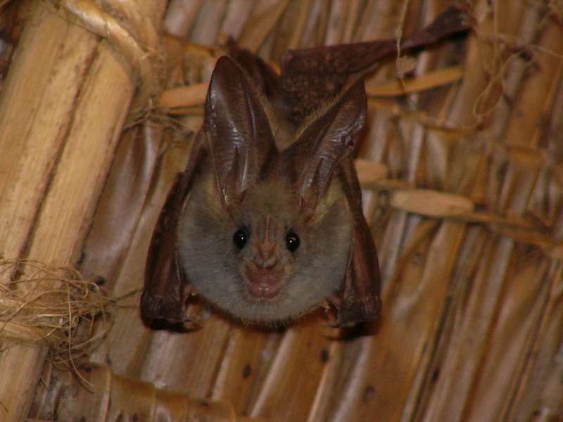
Bat
Then we drove out again with John to watch giraffes and other animals.
When giraffes drink, they are extremely nervous and ready to jump and run at the slightest disturbance. This may be so, because they cannot immediately move from the posture they need for drinking. It may also be so because of the danger of crocodiles.
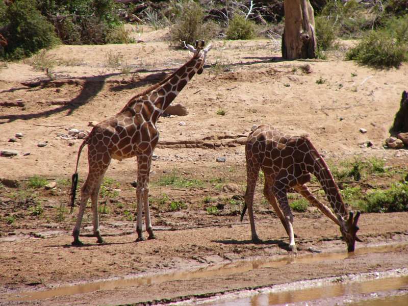
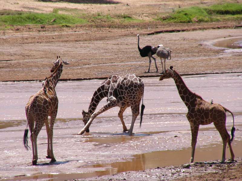
Giraffes drinking
After lunch we set out for the Samburu West Gate and drove on to Shivani's camp.
Along the way we met a group of elephants, one of them eating acacia branches. I have always wondered how they can eat these branches despite the terrible and slightly poisonous thorns, but they just tear them off and stuff them into their mouths, thorns and all, followed by slow and careful chewing.
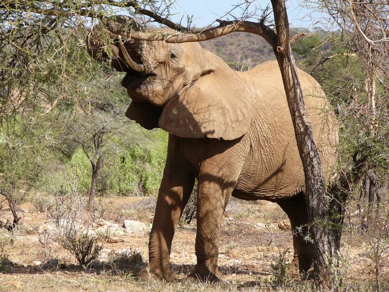
Elephant eating from an acacia tree
Eventually we reached Shivani's research camp. In the late afternoon we drove out with her to join her in her twice-daily routine drive and also to look out for the wild dogs. We did not find the latter, but found various other animals.
She and her assistants set up camera traps in places regularly frequented by wild animals.
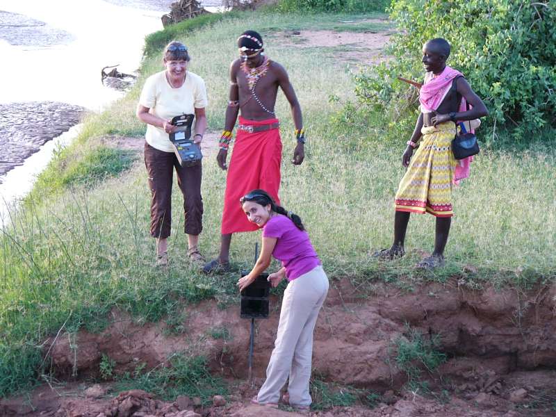
Shivani Bhalla, setting up a camera trap at a drinking spot at the shore of the
river
While we were watching this, elephants began to cross the river a little bit further downstream.
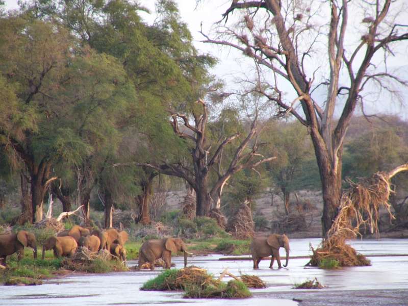
Elephants crossing the river
Unfortunately Shivani got a telephone call, saying that lions had killed a camel near the southern border of Buffalo Springs and that she should come as quickly as possible to prevent the killing of the lions. Since she could not reach that area in the short remaining daylight time and since driving at night is dangerous or impossible, she decided to leave early tomorrow.
We spent the night in one of Shivani's tents. Camp life always gives me the feeling of an adventure.
Shivani left before dawn, and we joined Paul, another researcher in her crew, in the morning drive across the Sasaab Lodge and community land.
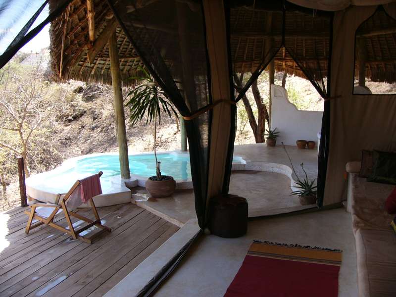
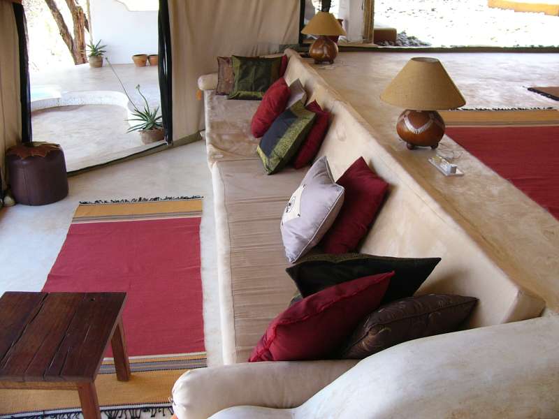
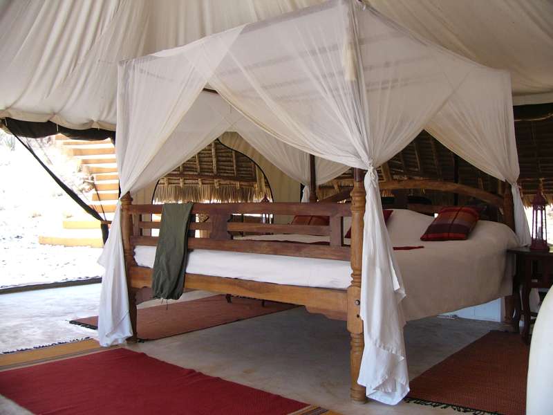
Later that morning, due to some peculiar circumstances, we moved into Sasaab Lodge, a luxurious place that would normally be far beyond our reach. The following photos show one of the tents and are approximately taken from left to right, showing first the basin, then the central living and sleeping area, then the bathroom, the shower downstairs and finally the view down to the bigger central swimming pool for all guests.
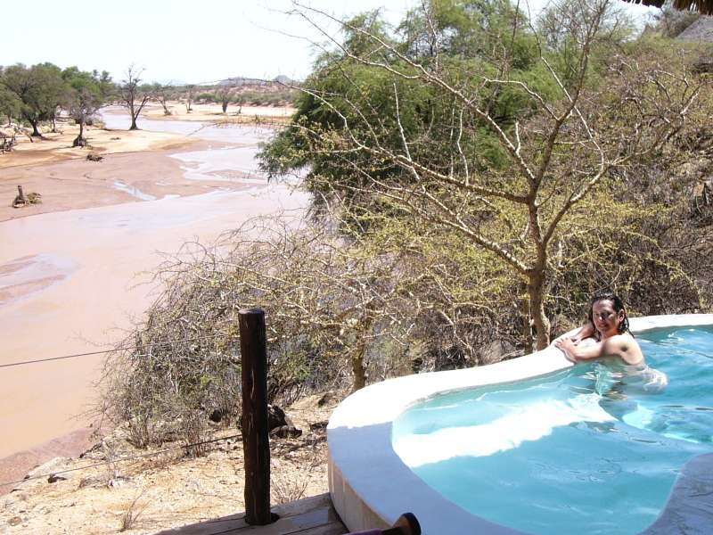
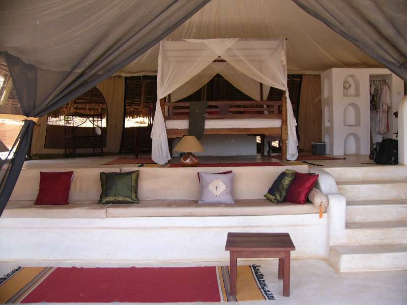


Sasaab Lodge—a room with a view
Everything is entirely open and located such that you can look out and down to the river, but nobody can see you. The central sleeping place with the big bed is under the tent roof and can be closed for the night by large mosquito netting, so you are essentially sleeping out in the open, but are still protected from insects and other animals.
The bed has an additional mosquito net that you can let down if you like.
We have changed our plans and decided to stay here instead of going to Masai Mara. This means more leisure and two fewer driving days. But the main reason to stay is the slim chance of seeing the African hunting dog.
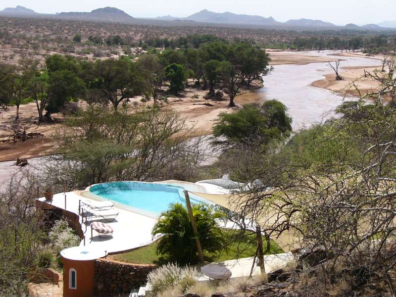
I do like Masai Mara a lot and almost always end my visits to Kenya there, but this is an exception. The density of wild animals is lower in the dry Samburu area, but the landscape is very exotic and makes me think of what terraforming Mars might achieve. Sasaab Lodge is a little paradise.
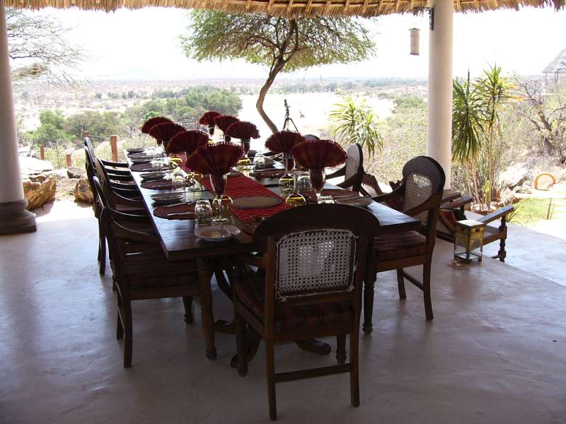
Table laid for lunch, Samburu River landscape in the background
I joined Shivani in her regular early morning routine drives at the beginning of dawn and also on the evening drive just before dark. She counts all bigger mammals along the way and can thus get data on their populations. I gain an insight into the work of a field researcher and also still have a slight chance to see the wild dogs.
The morning and evening drives with either Shivani or Paul and one of the Samburu warriors being the spotter were now routine. I joined them every day.
In the later morning I tried to take photos of all three prevalent hornbill species. A fourth one occurs in the area, but is very rare.

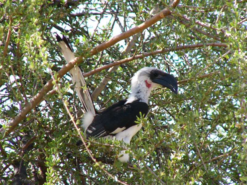


The three species of hornbill. From left to right: Eastern Yellow-billed Hornbill, Black Dwarf
Hornbill, Red-billed Hornbill, once more the Eastern Yellow-billed Hornbill
I began to try doing nothing, which is nowhere easier than in this warm climate, when you have a pool at your lodge room from which you can watch elephants.
Today we did not have to search the elephants—they were coming to us. These photographs were taken from the lodge.
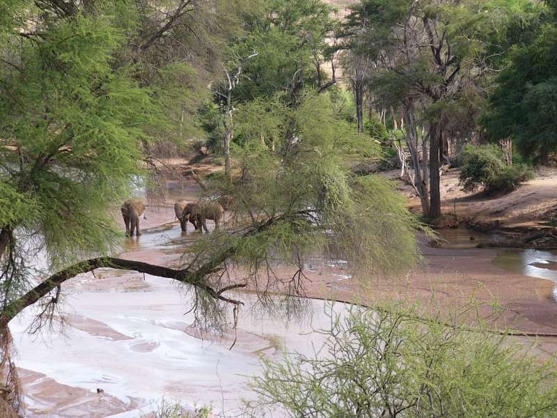
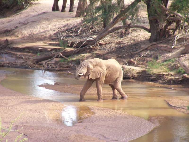
Left: elephant bulls in the river. Right: elephant bull drinking
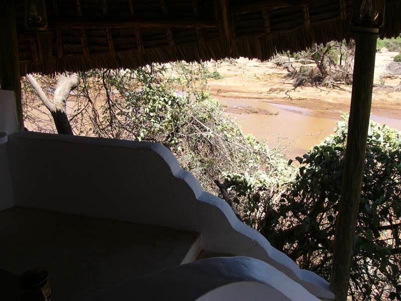
Here is a view from the river up to the lodge.
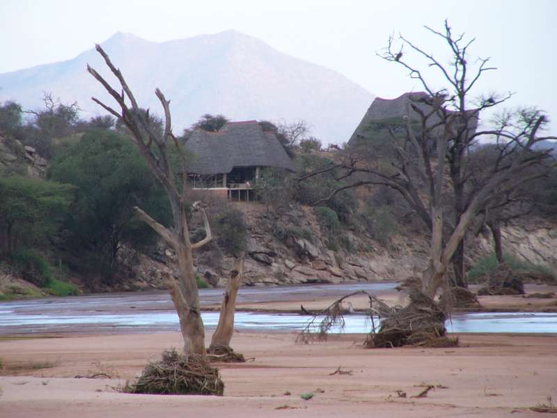
The left room was ours.
We spent our last day in Sasaab relaxing, having very good food and chatting with the lodge managers and the other guests.
After the last early morning drive with Shivani and Paul we had a last quick breakfast and then drove back towards Samburu.
We took two Samburu warriors along and drove to Samburu West Gate, paid our entrance fees for the passage, dropped the two warriors at the park headquarters near the bridge, and crossed the bridge from Samburu into Buffalo Springs.
As usual, we saw the most animals when we had the least time for them, when we had to leave and try to reach Nairobi on the same day.
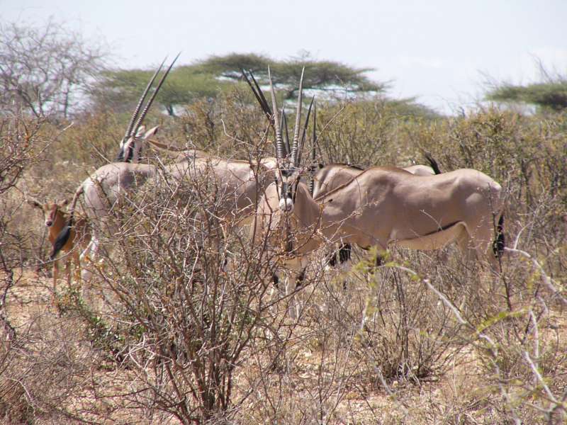
Oryx antelopes with baby hiding in the bushes
When we left Buffalo Springs and reached the Isiolo road, it was already noon. We drove through Isiolo and on to Nanyuki, where we pulled our hopefully last charge of Kenya Shillings from the ATM and filled our tank. The first petrol station did not have petrol, but they recommended another one, OiLybia, which was better stocked.
When we drove over the foot of Mt. Kenya and looked at the clock, it was already surprisingly late, almost 16 o'clock. We would drive into Nairobi in total darkness. Since we did not particularly like that, we pondered alternatives and decided to drive over into nearby Nyeri and try the Outspan Hotel, which is also the base station for the famous Treetops Hotel up in the Aberdare mountains.
The Outspan turned out to be full because of a conference, and it was already too late to catch the last transfer bus to Treetops, so we went to the nearby Green Hills Hotel and got a double room that was well good enough for roughly half the price.
That you could read these lines already on the same day is because the mobile phone Internet connection was good again, a high-speed connection through my mobile phone.
The Green Hills Hotel turned out to be good and functional, and so it just got its first Google Maps review from me. Look it up there, if you like.
We had breakfast in the hotel and then drove to the Aero Club of East Africa, Wilson Airport, Nairobi to have lunch, change some clothes, and repack our luggage for the flight.
Without much free time we drove over to the home of the Rasul family to return our car. We were welcomed very friendly there, handed over the car, and were then picked up by our friend Bashé, who had invited us to a party at his sister's home.
There we met a lot of people and had far too little time to talk with Bashé, his wife, and his friends and relatives. After about an hour we already had to leave for the airport.
Bashé and his wife took us there, and we were at the airport well in time to drop off our luggage without any last-minute stress, i.e. about 2½ hours before departure.
At that time there was no waiting line at all, and we could shed our luggage instantly, leaving us with a lot of time to go through immigration, have a little dinner in one of the airside restaurants, and buy the last few little gifts, like a package of Kenyan tea.
The flight turned out to be somewhat difficult. Our plane had a defect (something with its lights) and had to be repaired first, which took an hour and a half.
So we took off and landed the next morning in Paris after the normal 8-hour flight. There was a lengthy passport check directly when we exited the plane. After that we ran to the next gate, racing through passport and security checks along the way.
We reached the gate about 12 min before the planned departure time, but the plane had already left. We did not even see it. They must have finished boarding early, at least 15 min before the planned departure time.
This was a good exercise. We sweated and had to rest for a moment, before we went to the nearby Air France service counter and asked the very friendly and helpful woman what we should do now.
She made a telephone call and booked us on the next Air France flight to Munich "as a favor". That flight was now ostensibly overbooked, with only one free seat left, but we were anyway given two new boarding cards with seat numbers and wondered how that was possible.
Now we had a little more free time, so we rested and recharged our mobile phones with the help of thoughtfully placed electricity sockets next to some seat rows.
The flight was uneventful and quite nice. We arrived in Munich in good shape, were collected by one of our sons, and after arriving at our home, first of all we changed and took showers.
A good vacation was over. Too bad it was only three weeks long. We both agreed that we would both have liked to add at least another week. Maybe next year …
This article may be moved to a different web site later.
As mentioned above, I am trying to replace my Garmin GPSMap 60C with an Android smartphone, a Google/HTC Nexus One. The Garmin may still have to serve me while flying, because it has some special capabilities that are still missing on the phone, but I guess that is just a matter of time. Of course I have the Garmin with me as well, just in case the phone doesn't make it through the heat, thin air, dust, and vibration in the car.
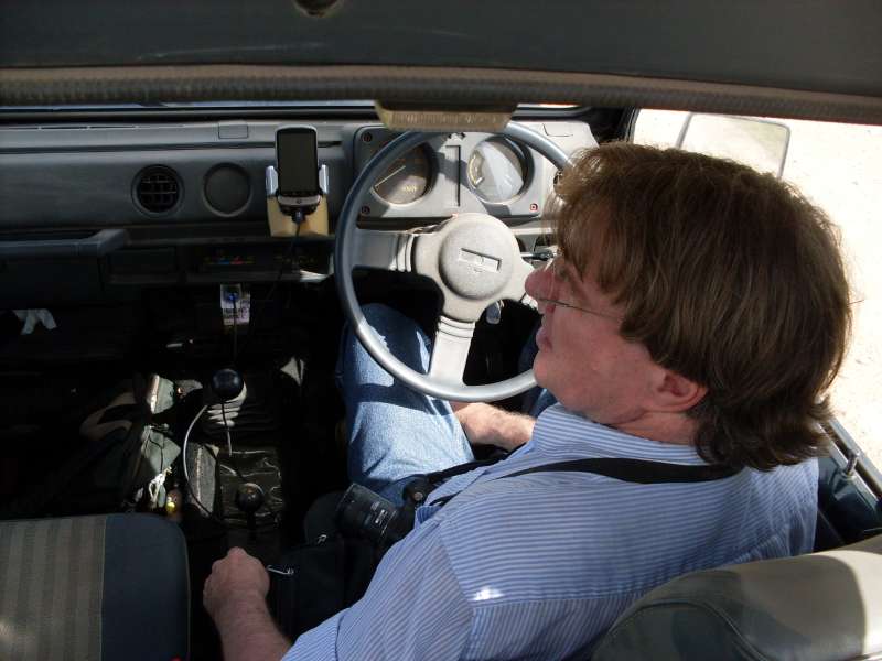
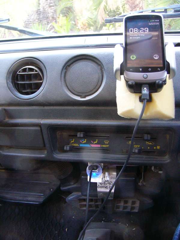
Smartphone mounted in the car with charger
I have published all tracks of my Nature Reserve Mapping Project through Google Maps, so everybody can now use them and even contribute to them. This also makes it very easy to use the tracks on a smartphone.
The phone failed the first test miserably—recording the intercontinental flight track. This is a strong test for any GPS receiver, because from inside an airliner you mostly receive only the satellites on one side of the plane through a window, which is a less than optimal constellation. But it is usually possible.
For most of the Munich – Paris – Nairobi flight the phone failed to get a location fix. When I switched on the much older Garmin, which has a much poorer receiver, it got a 6-satellite fix in a short time with accuracies down to 12 m, where the phone wavered between 2 and 4 satellites, but did not even get a fix when it had 4. (4 satellites are the required minimum for a 3-dimensional GPS fix.)
I have no clue about this failure. It is hard to understand, because the phone has a much more modern and sensitive GPS receiver chip built-in.
On the ground the phone worked better, which is not difficult in Africa, where you can usually receive the highest number of GPS satellites at the same time.
Of course a smartphone is nearly useless without an Internet connection, so the first thing I did on Monday morning was to buy a local SIM card and an Internet volume pack. Kenya is one of the most advanced countries when it comes to mobile phone application, and the prices are low.
Once online, I could use Google Maps, including navigation. It does not do turn-by-turn navigation here, but it calculates a fair route and draws it on the moving map, which is fair enough for the time being.
Areas without mobile phone coverage are still a problem for Google Maps. I have tried a few offline mapping programs, but the integration with Google Maps is lacking, and so it is difficult to have my routes, tracks, and waypoints on the map.
I tried one program called Locus (the free version), but the program turned out to be difficult, for some functions nearly impossible, to operate because of its extremely poor user interface design. After learning its idiosyncrasies I can now use it to show waypoints, tracks and routes, when we are outside phone coverage and therefore have no Internet connection.
In spite of all its shortcomings, Locus at least has the advantage of showing routes, which Google Maps misses in its import function.
One problem with Google Maps and My Tracks is that they do not employ any sensible caching. For example, when I have several parts of My Maps loaded, but lose the phone connection and close and reopen Google Maps (which is very easy to do by mistake and sometimes has to be done for other reasons), then all My Maps are gone and cannot be reloaded until I get into an area with phone coverage again. This is in spite of the fact that a ridiculously small amount of storage would suffice to cache all of My Maps.
Google Maps is, as usual, a lab demo and fair-weather, narrow-purpose program that usually fails when the real-world demands rise. It is functionally meager and lacks many simple functions that are needed under certain circumstances other than simple road navigation in an industrialized country. Its functionality is very narrow, compared, for example, to a Garmin GPS receiver. You cannot even define a waypoint or personal point of interest with that program. You can do that with My Tracks, but you don't see any newly recorded tracks or waypoints instantly in Google Maps, until you go through a time-consuming and somewhat complex operation to export and upload to My Maps.
This would be quite acceptable, if other programs took up the slack and provided the missing functions, which some of them do, like Google's own My Tracks, but then the problem is the integration of these functions, not to mention the ever-growing effort to learn the intricacies of each program. You don't want to switch between programs all the time, and you often want combinations of functions that can probably only provided by one program, but not by two or more independent programs. In short, the program to completely replace a Garmin GPS receiver does not seem to exist yet, except that Garmin themselves provide one, but only for the iPhone.
For track recording I used Google's My Tracks, which I had tested successfully at home. This choice turned out to be a big mistake. The program has a gruesome defect that leads to total data loss, i.e. all hitherto recorded and not yet exported tracks are entirely erased.
I don't know what triggers the error. Perhaps it occurs when I record a longer track, like my movements over a whole day. Another hypothesis, that the defect is triggered by crossing the equator, turned out not to be true.
But whatever it is, data loss is about the worst a program can do to you, and under normal circumstances, i.e. enough available alternatives, I would boycott not only the program, but also its manufacturer. But since Google sits on a near-monopoly, they can all too easily afford to ignore the requirements of a high-demand user like me, but I cannot afford to boycott Google.
My Tracks has several other defects, like the track becoming invisible or flickering such that it is mostly invisible, not loading required maps. And it also depends highly on a functioning radio link. It hardly caches anything, so once you leave a covered area, the program very quickly loses much of its functionality.
It is a real pity, because My Tracks is, at first sight, excellently designed and fulfills its few functions very well, until you hit one of its defects.
This proves time and again that Google software is often of horribly poor quality and should never be used for any important task, unless you have tested it very thoroughly and are absolutely convinced that it is up to the task. Google software often has the quality of a demo program that has not been designed for serious use, let alone typical conditions in Africa. To quote from the movie The Matrix—"Welcome to the real world."
So I began to use Locus for track recording. It fared no better. It can use either My Tracks or its own track recording function, so I chose the latter. It worked well for a while, but when I opened the program after a somewhat longer time, everything was gone as if the program had been shot down and restarted from scratch, which may well be what had actually happened.
I'm currently using My Tracks, exporting every track after it has been recorded to avoid losing more than one track at a time, but the situation is very unpleasant.
My hope is that better programs will come our way. Meanwhile it is possible to solve the African navigation problems with some preparation and judicious and careful use of two or more suitable programs. I'm still struggling on, trying to avoid to fall back on the old Garmin GPS receiver and will try to report some more details of what I find while trying to navigate.
All that said, I would now consider the combination of Google Maps, My Tracks, and the free version of Locus a barely sufficient and viable solution for the navigation demands of a safari, if track recording does not have a high priority. Along with the hope that better software will become available, travellers can now use their smartphone and forgo the purchase and learning effort of a dedicated GPS receiver.
The good news is that the ventilation grille phone holder works well and that the phone has so far easily survived heat with the help of the air vent it is attached to, dust, and vibration with the help of a piece of foam rubber that also adjusts its vertical angle. Also the modified charging cable does its job very well, charging the phone fully with nearly 1 A charge current, while it navigates and has its screen lit.
If in this text you find any typos, orthographic errors (even small ones), ungrammatical sentences, wrong or illogical information (like wrong names of birds), if you want me to write more details about something in particular, or if you want one of the photos in full resolution (usually 1,600 x 1,200 pixels), please click on the email sign below and write to me. Many thanks!
Copyright © 2011-2023 Hans-Georg Michna.
Private homepage – Hans-Georg Michna
Kenya travel reports: 1999, 2000, 2002, 2003, 2004, 2005, 2006, 2007, 2008, 2009, 2010, 2011, 2012, 2013-Goma, 2013, 2014, 2015, 2016, 2017, 2018, 2019
Kenya Safari Travel Plan, Kenya 1980-2000 photos

hits since 2011-05-01
Free PHP scripts by PHPJunkYard.com