A happy geocacher
Private homepage – Hans-Georg Michna
Baumgartenschneid
GPS Route, Geocaching Information, Story
HANS-GEORG MICHNA
A happy geocacher
Each of the following route files contain two routes, BH for the ascent from the Tegernsee train station to the summit, including the geocache, and BR for the descent.
Note: If you come by car, it is a good idea to park the car at BR36 and begin your hike via BR37, Sonnleitenweg, Auerweg, Auerbauer to BH09 (see also topographic map).
Jede der folgenden Routendateien enthält zwei Routen, BH für den Aufstieg vom Bahnhof Tegernsee über den Geocache bis zum Gipfel und BR für den Abstieg.
Anmerkung: Wenn man mit dem Auto kommt, dann ist es eine gute Idee, das Auto bei BR36 zu parken und die Wanderung über BR37, Sonnleitenweg, Auerweg und Auerbauer nach BH09 zu beginnen (siehe auch topografische Karte).
The rough plan for this trip existed in my head for at least a month, but I never got to it until last week. But now, as the fall shows its last fine weather, the pressure increased to get it going, so I wrote a first message to friends on Thursday morning, with a still unfinished plan.
With first class help and the knowledge of two of my friends, who are experienced mountain hikers, the plan was quickly finalized, and I began to study the weather forecast.
First I had thought we could do it on Monday, November 1st, which is a public holiday in Bavaria (All Saints' Day, the German version of Halloween) or perhaps a week later, but then it turned out that the day with the very best weather would be Saturday already, with some Föhn (warm, southerly wind across the Alps), much sunshine and no rain.
Among the mountains, after a short examination only one proved suitable, the Baumgartenschneid. All other mountains either had no guest house that was still open, no geocache, or they were too high and to far south in the Alps.
The Baumgartenschneid is a mountain east of the Tegernsee lake with a peak height of 1,444 m above sea level. We picked a relatively short round walk, such that we never had to go the same way back we came on, beginning and ending in the town of Tegernsee, named after the lake, directly to the north of Rottach-Egern. The meeting point was at 11 o'clock at the Tegernsee train station.
Before that, however, I had made an earlier meeting point for those who are interested in geocaching, at 9 o'clock in front of the city hall in Holzkirchen. There is a geocache that consists of a riddle, which you have to solve first to be able to find the real geocache.
You can find background information on geocaching at www.geocaching.com, where all known geocaches are registered.
The weather turned out to be a dream come true, and Ines, one of our friends, found her first geocache (and wrote that into the cache log), and that was the one on the Baumgartenschneid.
Oliver, another friend, also opened his first geocache, and that was even the complicated, two-step multi-cache in the Holzkirchen area in the morning, as planned (Kokopelli No. 3, see www.geocaching.com).
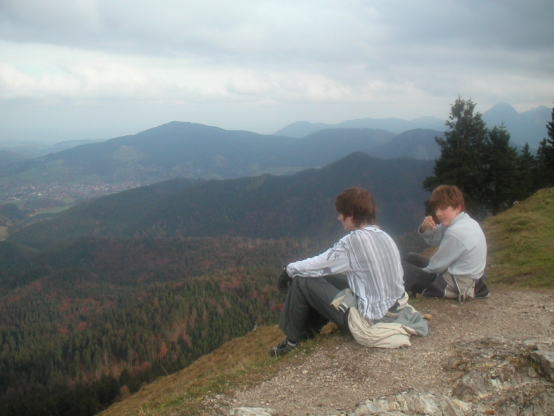
The hike was perceived by the old hands as relatively easy, by the less well trained as somewhat tiresome, but that's how it should be.
We found an interesting route, which first passes by the geocache and then arcs around and leads past the geocache to the Baumgartenschneid mountain peak. At a right angle one then walks down and later reaches the alm (mountain restaurant, this one named "Zum Galaun"), where we, of course, stopped for a good meal and drink, before we continued down the final descent.
We kept to our schedule very well, better than I had thought. We started half an hour late (somebody was late), at 11:30, but returned only 15 minutes late, at 17:15. In the alm we spent about 50 minutes.
Our actual route can be seen here.
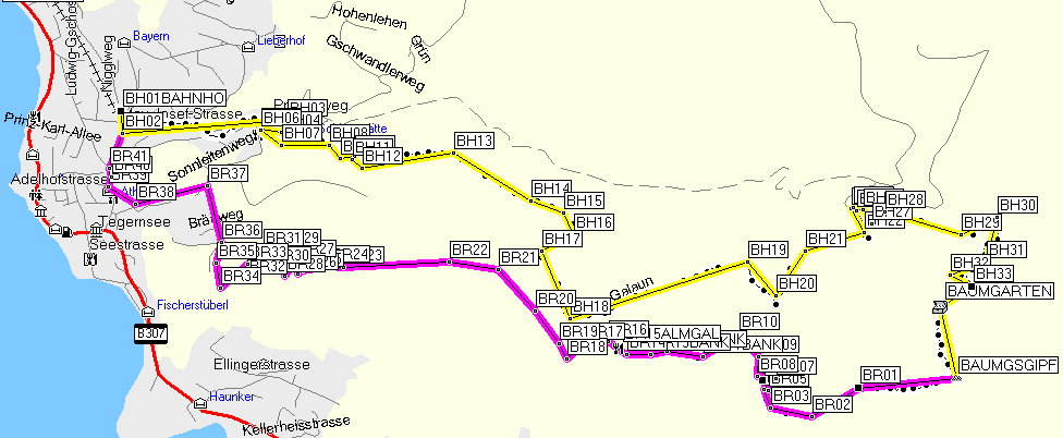
Route (yellow = ascent, violet = descent)
As you can see, we initially climbed up along the southern edge of the Alpbach valley, but not deep down in the valley (dashed line). But please see the note at the top in Links and downloads – GPS route files; there is a better alternative if you come by car.
The route I had originally planned led approximately from BH20 directly to the peak, where a footpath was shown in the topographical map, but in reality that path was not there. We simply couldn't find one. In the map you can even see a small trace of our failed attempt to find that path. However, we had thought of this possibility before, had even talked about it, and had an alternative ready, which turned out to be excellent, particularly when one wants to pass by the geocache.
So we kept walking east and thus arced back to the geocache (BAUMGARTEN in the map above) and soon thereafter to the peak (BAUMGSGIPF in the map). This is a very nice variant, because it would be unnecessarily tiresome and also boring to do the steep ascent to the peak twice and walk the same way back. You can bybass the peak partly, but I prefer routes where you never have to walk the same way back, but instead always see something new.
The following picture shows the altitude profile of the ascent to the peak, then the descent to the restaurant.
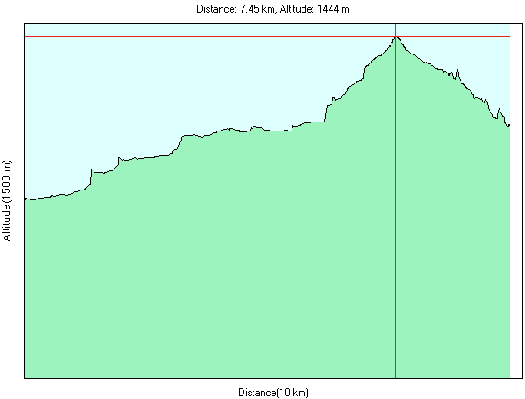
Altitude profile
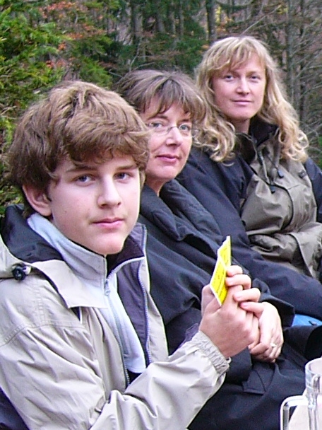
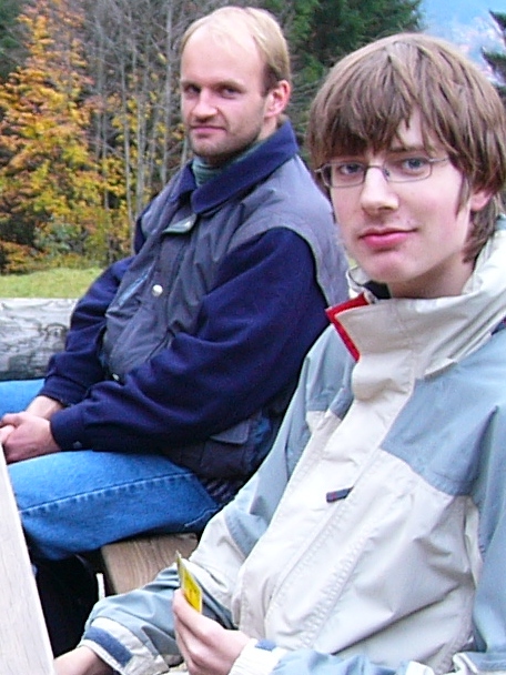
We had met at 9 o'clock at the city hall in Holzkirchen, where Oliver joined up with us. At the building there is a signboard made of stone, which you can see in the left photo and which praises the digging of a well in the 15. century (before Columbus discovered America, by the way). To find the actual geocache, we had to read certain digits from the board, which could them be assembled to the target coordinates.
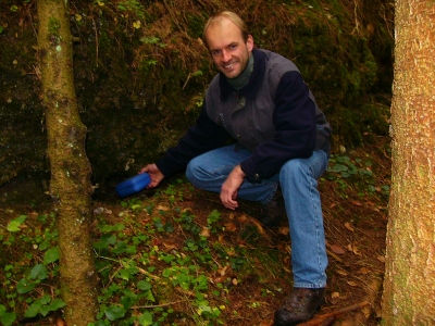
The second photo shows the actual find outside the town in the forest.
The first geocache in the morning
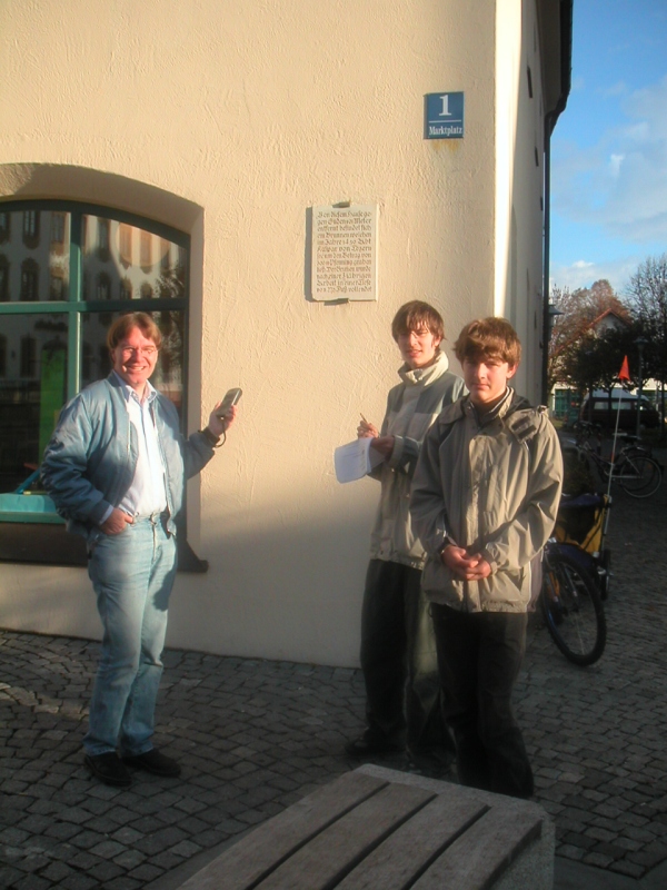
After this we drove on the the Tegernsee train station, the meeting point for the mountain hike.
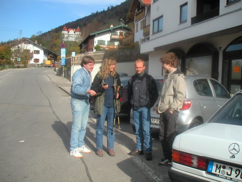
Meeting at the Tegernsee train station
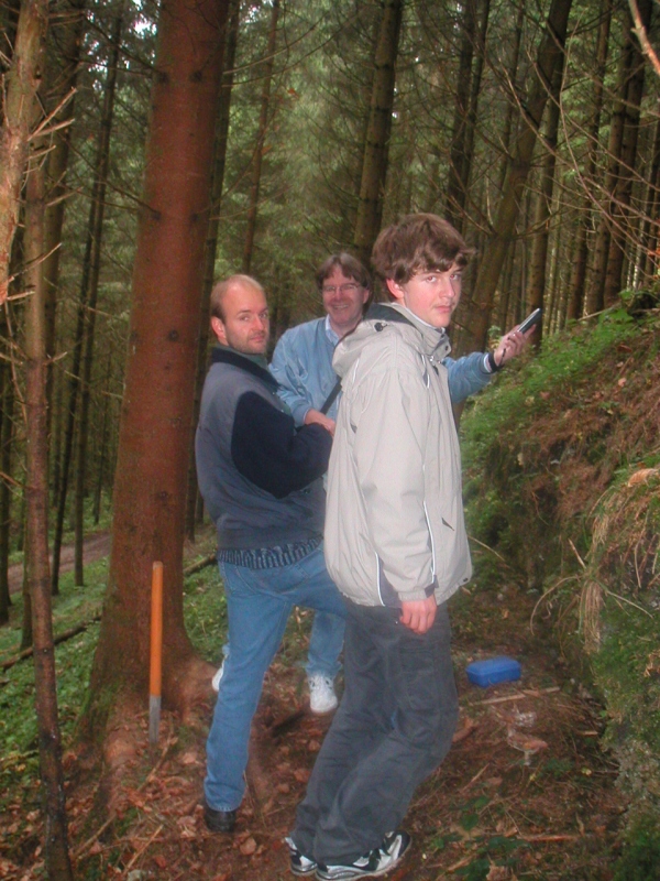
The second geocache was found by Ines, another friend of ours. It was a micro cache, a tablet tube. In it there was essentially a rolled-up piece of paper, the geocache log. Ines enthusiastically entered her name and our names (adding "my first geocache" in German), then it was carefully hidden again under a tree root.

The second geocache on the Baumgartenschneid
The following pictures show some of us at the Baumgartenschneid summit cross. On the second photo you can see lake Tegernsee in the background.
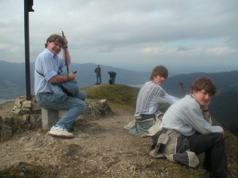
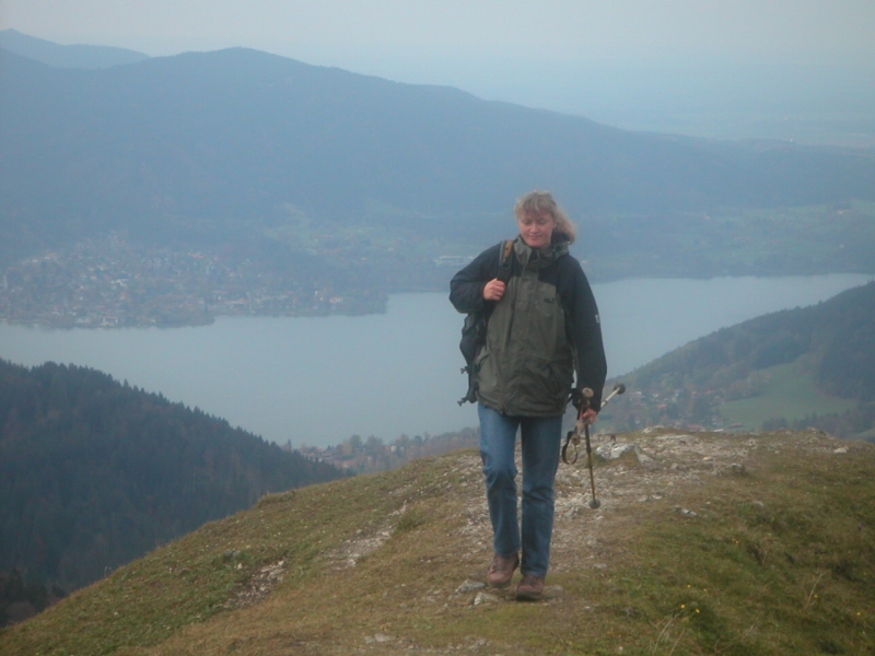
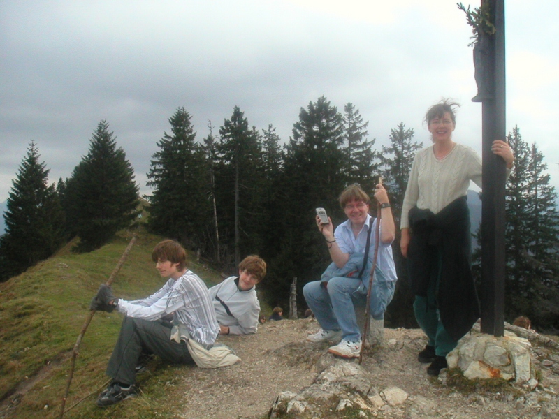
At the Baumgartenschneid summit cross
 |
On the way back we passed by the alm "Zum Galaun" and, of course stopped
to eat and drink. The alm is nice and recommendable. After this nice rest we hiked more or less along the highest line of the mountain range back down to Tegernsee. While hiking I improved the GPS waypoints and thus documented the complete route for the next time, such that this path is now easy to find. |
 |
Die Tour wurde sehr kurzfristig geplant. Ich hatte so etwas schon lange vor, bin aber nie dazu gekommen, einen richtigen Plan zu machen. Jetzt aber, wo der Herbst sich neigt, entstand ein gewisser Termindruck durch die Witterung, so dass ich am Donnerstag früh eine erste Bekanntmachung im Freundeskreis schrieb, mit einem noch unfertigen Plan.
Mit hervorragender Hilfe und den Kenntnissen zweier Freunde, die erfahrene Bergwanderer sind, entstand daraus rasch ein fertiger Plan, und ich begann, die Wettervorhersage zu studieren.
Ich hatte erst gedacht, wir könnten es vielleicht am Montag, dem 1. November machen (Feiertag Allerheiligen) oder vielleicht eine Woche später, aber dann stellte sich heraus, dass der Tag mit dem voraussichtlich allerbesten Wetter schon der Samstag sein würde, mit etwas Föhn, viel Sonnenschein und ohne Regen.
Als Berg kam nach kurzer Prüfung überhaupt nur einer in Frage, die Baumgartenschneid. Alle anderen Berge hatten entweder keine bewirtschaftete Alm zum Einkehren, keinen Geocache oder waren zu hoch und zu weit südlich in den Alpen.
Die Baumgartenschneid ist ein Berg östlich des Tegernsees mit einer Gipfelhöhe von 1.444 m über dem Meeresspiegel. Wir haben uns einen relativ kurzen Rundweg ausgesucht, so dass wir nie denselben Weg zurückgehen mussten, den wir gekommen waren, beginnend und endend im Ort Tegernsee am südlichen Ostufer des Tegernsees, direkt nördlich von Rottach-Egern. Treffpunkt war um 11 Uhr am Bahnhof Tegernsee.
Vorher allerdings hatte ich für diejenigen, die sich besonders für Geocaching interessieren, noch einen anderen Treffpunkt gemacht, vor dem Rathaus in Holzkirchen um 9 Uhr. Dort gibt es einen Geocache (englische Aussprache: djiokäsch, halb-deutsche Aussprache: geokäsch), der ein Rätsel enthält, das man erst lösen muss, um den eigentlichen Cache zu finden.
Hintergrundinformationen zum Geocaching findet man auf www.geocaching.com, wo auch alle bekannten Geocaches verzeichnet sind.
Das Wetter war traumhaft, und Ines hat ihren ersten Geocache gefunden (und das auch ins Logbuch geschrieben), nämlich den auf der Baumgartenschneid.
Oliver hat ebenfalls seinen ersten Geocache geöffnet, und sogar einen komplizierten zweistufigen Multi-Cache in der Gegend von Holzkirchen am Morgen, wie geplant (Kokopelli Nr. 3, siehe www.geocaching.com).
Die Bergwanderung wurde von dan alten Hasen als eher leicht empfunden, von den Ungeübten als etwas anstrengend, aber das muss ja wohl so sein.
Wir haben eine interessante Route gefunden, die zuerst am Geocache vorbeiführt und dann von dort auf die Baumgartenschneid. Im rechten Winkel dazu läuft man dann wieder hinunter und kommt dort an der Alm vorbei (Zum Galaun), wo wir natürlich eingekehrt sind und gut gegessen und getrunken haben, bevor wir uns an den endgültigen Abstieg machten.
Unseren Zeitplan haben wir sehr gut eingehalten, besser, als ich gedacht hatte. Wir sind eine halbe Stunde zu spät losgelaufen (jemand kam etwas verspätet), nämlich gegen 11:30 Uhr, aber nur eine Viertelstunde zu spät zurückgekommen, nämlich gegen 17:15 Uhr. In der Alm haben wir etwa 50 min verbracht.
Unsere tatsächliche Route ist hier zu sehen.
Route (gelb = Aufstieg, violett = Abstieg)
Wie man sehen kann, sind wir anfangs an der südlichen Oberkante des Alpbachtals hinaufgekraxelt, aber nicht in der Talsohle (gestrichelte Linie). Aber beachte bitte die Anmerkung oben im Abschnitt Links and downloads – GPS route files; es gibt eine bessere Alternative, wenn man mit dem Auto kommt.
Die Route, die ich eigentlich geplant hatte, hatte beim Aufstieg ein Stück Weg, etwa von BH20 direkt zum Gipfel, das zwar auf der topografischen Karte existierte, aber nicht in der Wirklichkeit. Der eingezeichnete Pfad war einfach nicht zu finden. Man sieht noch eine kleine Spur unseres vergeblichen Versuchs, ihn ausfindig zu machen. Wir hatten aber genau diesen Fall schon vorher für möglich gehalten und besprochen und hatten daher eine Alternative parat, die sich als ganz ausgezeichnet herausstellte, insbesondere, wenn man den Geocache finden will.
Daher sind wir dann weiter nach Osten gegangen und so in einem Bogen erst zum Geocache gekommen und kurz darauf auf den Gipfel. Das ist eine sehr schöne Variante, weil es unnötig anstrengend und gleichzeitig langweilig wäre, den steilen Anstieg zum Gipfel zweimal hintereinander zu machen und dabei denselben Weg wieder zurückzugehen. Man kann zwar den Gipfel teilweise umgehen, aber ich bevorzuge Routen, bei denen man denselben Weg überhaupt nicht zweimal zurücklegen muss, sondern immer etwas Neues sieht.
Das folgende Bild zeigt das Höhenprofil des Aufstiegs bis zum Gipfel und dann des Abstiegs bis zur Alm.
Altitude profile
Wir hatten uns um 9 Uhr schon am Rathaus Holzkirchen getroffen, wo auch Oliver zu uns stieß. Am Gebäude ist eine Tafel, die man im linken Bild sehen kann und die die Erstellung eines Brunnens im 15. Jahrhundert preist. Um den eigentlichen Geocache zu finden, musste man aus dieser Tafel einige Ziffern herauslesen, die sich dann zu den Zielkoordinaten zusammensetzen lassen.
Das zweite Bild zeigt den eigentlichen Fund außerhalb der Stadt im Walde.
Der erste Geocache am Morgen
Danach fuhren wir zum Bahnhof Tegernsee, dem Treffpunkt für die Bergwanderung.
Treffen am Bahnhof Tegernsee
Den zweiten Geocache fand Ines. Es war ein sogenannter Micro-Cache, ein Tablettenröhrchen, in dem im Wesentlichen ein Blatt Papier eingerollt war, das Geocache-Logbuch. Ines hat sich und uns alle mit Begeisterung eingetragen ("Mein erster Geocache"), dann wurde er wieder sorgfältig unter der Baumwurzel versteckt.
Der zweite Geocache am Baumgartenschneid
Die folgenden Bilder zeigen jeweils einige von uns am Baumgartenschneid-Gipfelkreuz. Auf dem zweiten Bild sieht man im Hintergrund den Tegernsee.
Am Baumgartenschneid-Gipfelkreuz
|
|
Auf dem Rückweg kamen wir an der Alm "Zum Galaun" vorbei und kehrten
natürlich ein. Die Alm ist zu empfehlen. Nach dieser Ruhepause kraxelten wir mehr oder weniger auf der höchsten Linie des Bergkammes nach Tegernsee zurück. Ich habe während der Tour die GPS-Waypoints verbessert und die komplette Route so für die nächste Wanderung dokumentiert, so dass man diesen Weg nun leicht wiederfinden kann. |
|
Private homepage – Hans-Georg Michna
